
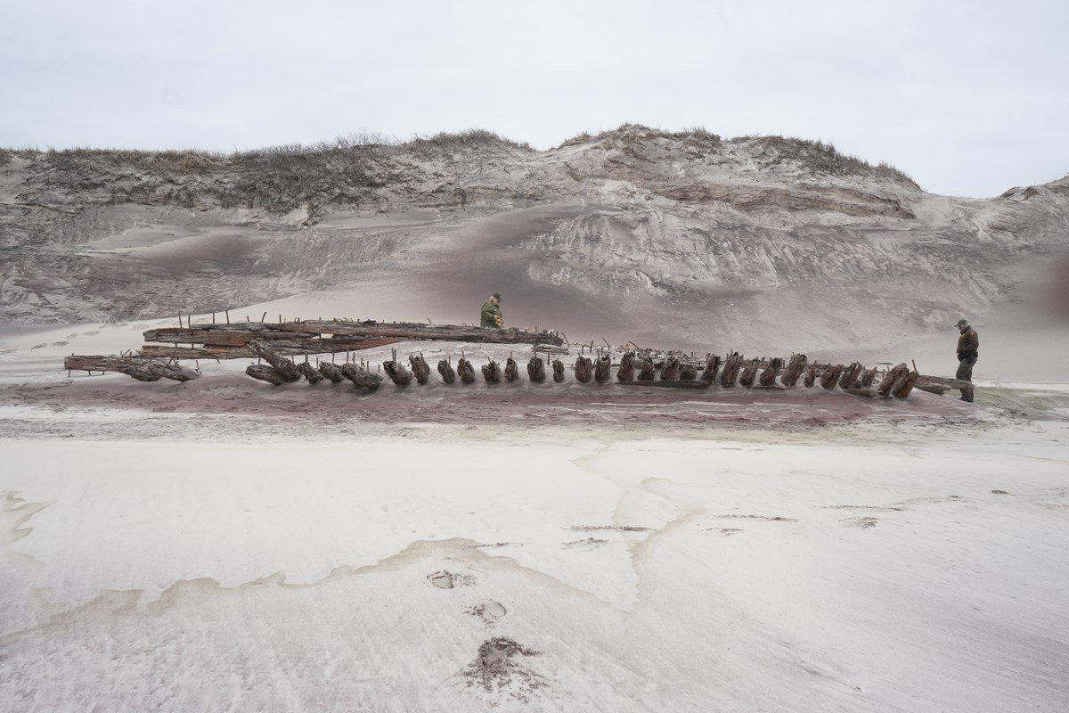

The hull believed to be the “Bessie White,” which lies beneath Skunk Hollow and Whalehouse Point on Fire Island.
(NPS/Fire Island National Seashore)
By Isabella Cavallo
Hidden beneath the sands of Fire Island are the remains of the “Bessie White” shipwreck, which crashed into the shores of the island a century ago. The wreckage was a long-forgotten memory, until Hurricane Sandy unearthed the hull of the ship on the eastern end of the island and entranced the nation.
The adventurous story of the “Bessie White” begins with a passage in the heart of winter. On Feb. 6, 1922, the ship set sail from Newport News, Virginia, to St. Johns, New Brunswick. It was clear sailing as the crew of 20 men headed towards the Canadian province until the skies were clouded by a dense fog. The fog obstructed the crew’s view and the ship ran aground on a sandbar across from the deactivated Smiths Point Coast Guard Station. The ocean water began to flood into the ship, causing the men to desert the “Bessie White” and its cargo, sailing to safety on lifeboats.
During the chaos, Seaman James Rynburgh hit his head and was knocked unconscious. The castaways worked together to rescue him and carried him eight miles in search of medical aid. They arrived at the Bellport Coast Guard Station and the ship was left behind, until two bright-eyed men with visions of a movie thriller bought the rights to the wreckage. Foster Stills and Harry Paine of Patchogue hoped to salvage some of the ship’s remains to sell for a profit, but much of the ship’s equipment was stolen by thieves and the natural forces of the tide. After saving what they could from the ship and calling off their movie plans, the “Bessie White” was officially abandoned once and for all.
The dilapidated “Bessie White” became a popular attraction for years after it was abandoned and it brought the shipwreck to life for locals and tourists. Eventually, the ship sunk into the sand and was unseen until Hurricane Sandy.
While Fire Island is no stranger to shipwrecks, the “Bessie White” was and still is the only shipwreck people could easily walk to on Fire Island with a two-mile hike from Watch Hill. The attraction helps to enrich the island’s history of shipwrecks and how residents adapted to its treacherous tides.
“That breath of history about Fire Island is big here,” said Chris Olijnyk from the Fire Island National Seashore (FINS). “The technological advances that we’ve had to make to even increase shipping, you know, the first lighthouse here was created because of the shipwrecks. Then it had to become bigger because of another famous shipwreck in 1850. As it keeps going, what we accomplished and how we had to adapt to the world as we change it shows how we made it better for ourselves.”
While Hurricane Sandy fully uncovered the skeleton of “Bessie White” she was soon hidden beneath the sands again until the next powerful storm. “It comes and goes,” Olijnyk said of the disappearing and reappearing ship. “There’s no real way of knowing when it will show up again.”
In honor of the centennial, FINS searched for ways to preserve the artifact and share the history of the “Bessie White.” They teamed up with the National Park Service’s Submerged Resources Center to mark the shipwreck pieces through a public engagement program, Shipwreck Tagging and Archaeological Management Program (STAMP).
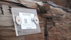
The STAMP tag now affixed to the historic wreckage. (NPS/FINS)
“As part of the STAMP program, we’re looking to see as part of that larger effort exactly where do the shipwrecks go? Where do the pieces go? How do the currents move pieces? And do they move far? Because we’ll find unidentified pieces of wood on the beach that look like they’ve been crafted and might be shipwreck pieces, or they could be pieces of a bulkhead. It can be difficult to figure out which is which.”
STAMP was developed by the Florida Public Archaeology Network (FPAN) to monitor historic shipwrecks and their remains. FINS rangers and curatorial staff placed informational and interactive STAMP tags on parts that are believed to be the “Bessie White.” The public engagement aspect of the STAMP tags is the QR codes, which visitors can scan to submit photographs, GPS coordinates and more.
FPAN and the National Park Service will receive data visitors submit and can use this to track the movement of the shipwreck due to natural forces and currents over a long period of time. Further down the line, this data can have alternate applications in relation to weather and climate change.
“We think in the long term if we have a large data set after a while, we might be able to apply that to changes in climate to see if the currents change in speed or strength and any patterns.”
For now, visitors can appreciate the historic wreckage as a living artifact and contribute to the data collection by scanning the QR codes. Fire Island rangers currently reported the ship to be visible.
“If you have the opportunity, if the weather hangs the same, probably for the rest of June, get over to Watch Hill and walk over and you might be able to see [the “Bessie White”] in person before another big storm covers it,” Olijnyk said.
There are 155 shipwrecks documented on Fire Island’s shores, but the story of “Bessie White” shows there may be other mysterious wreckage lying beneath the sandy beaches waiting to be discovered. Explore the 100-year-old ship’s skeleton and keep an eye out for any signs of other abandoned ships.