

Open space doesn’t defend itself. Once a coastline is developed, the wetlands that filtered nutrients, buffered storm surge, and anchored the shoreline are gone. The window to act is narrow, and on Long Island, it’s closing.
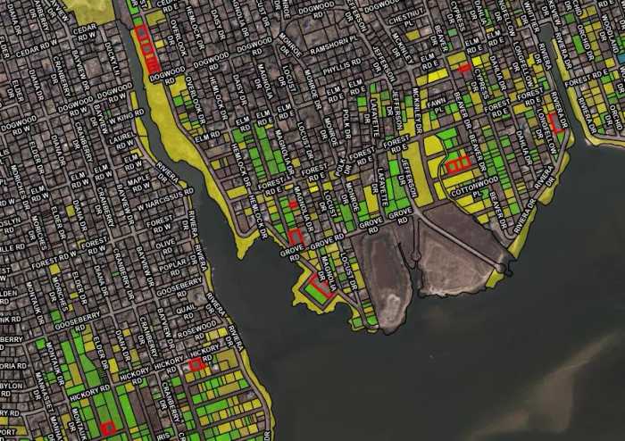
In June, the Town of Brookhaven approved spending nearly $475,000 to acquire 17 properties in Mastic Beach, permanently preserving nearly 3.5 acres of coastal wetlands while keeping blighted single-family homes out of developers’ hands. The funding comes from the Joseph Macchia Environmental Preservation Capital Reserve Fund, established in 1998 to purchase environmentally sensitive land, including wetlands and river corridors.
Several properties along West Riviera Drive abut Pattersquash Creek, a tidal waterway whose surrounding marshland filters runoff, absorbs flooding due to storms, and provides habitat for species. Other lots are scattered across Beaver Road, Grove Road, Cypress Drive, and Magnolia Avenue — low-lying streets where coastal erosion and chronic flooding have repeatedly tested the community’s resilience.
“It’s a beautiful community, but it has felt the effects of sea level rise,” Town Supervisor Dan Panico said in a statement. These are “more parcels added to the Mastic-Shirley Conservation Area that will forever be wild for our environment and also keep the character of Mastic Beach,” he added.
Mastic Beach was developed in the 1920s as a summer retreat, and its affordable housing has made it a home base for working-class families. In 2010, residents incorporated as a village, in part to take control of their waterfront and pursue climate-resilient infrastructure.
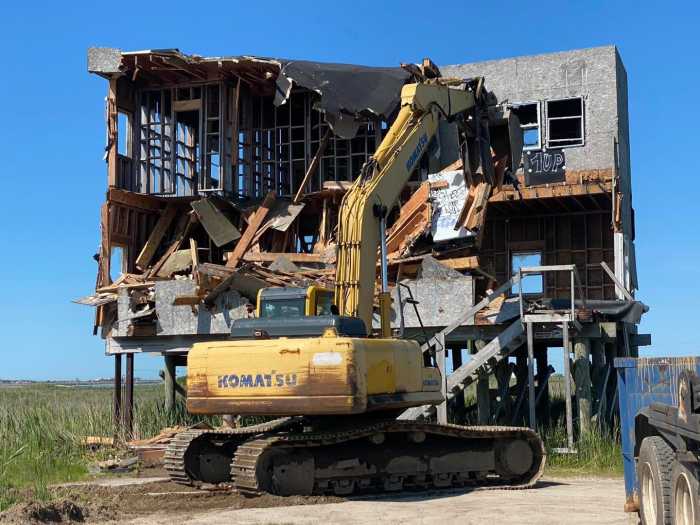
The costs proved overwhelming — storm drains, vulnerable roads, and the full burden of municipal maintenance on a modest tax base — and the village dissolved in 2016. Four years earlier, Superstorm Sandy tested the community, flooding low-lying streets and making clear what accelerating sea-level rise would mean for single-family homes most vulnerable on the coast. What remained after the village dissolved was a publicly accessible coastline and a community that better understood than most what it costs to ignore rising water.
Since Sandy, a patchwork of Suffolk County, municipal, and nonprofit groups, including the state-designated South Shore Estuary Reserve, have spent years negotiating with property owners across Long Island to preserve open space to protect human and wildlife habitats.
“The opportunities to protect new parcels are getting fewer and further between,” said Alison Branco, climate adaptation director for The Nature Conservancy in New York. “And that means when those opportunities do come around, they’re even more critical.”
Branco said Brookhaven has done solid work in this part of town precisely because the geography demands it. The Mastic-Shirley Conservation Area designation, created by Suffolk County, provides a framework that lets the county turn over tax-delinquent and other properties to the town rather than auctioning them off — a mechanism that has helped remove flood-prone land from the development pipeline.
“Long Island has lost nearly all of its salt marsh that isn’t in some form of protected open space,” Branco said.
The marsh that remains is being squeezed between rising sea level and development. Acquiring land adjacent to those marshes creates room for them to migrate inland as water levels rise. Without that space, even protected wetlands can be lost to coastal erosion.
“We have to make some space for that salt marsh to continue into the future,” she added.
Branco said no single town can solve this alone. What Brookhaven is doing through its reserve fund, other towns on eastern Long Island accomplish through their regional Community Preservation Fund, a 2% real estate transfer tax established by a state referendum in 1991 that has generated nearly $2 billion and protected over 10,000 acres across the East End.
But Branco views the fragmented landscape of municipal programs, county initiatives, state agencies, and nonprofits as a feature rather than a flaw. “They do work together quite a lot and often share priorities,” she said. When one entity can’t act on a property, another often can. Nonprofits and land trusts, she added, aren’t bound by the same assessment rules that limit what government agencies can offer, allowing them to bridge funding gaps that would otherwise kill a transaction.
The Long Island Conservation Alliance, formerly the Long Island Conservancy, is now positioned to play exactly that role across the region. The Woodbury-based organization recently received official land trust certification, enabling it to accept conservation easements and permanently protect properties from development in Nassau, Suffolk, Queens, and Brooklyn.
“Becoming a land trust marks a major step forward in our efforts to protect our natural ecosystems,” Executive Director Devon Giordano said in a statement. “Land conservation and restoration is labor-intensive, time-intensive, and resource-intensive, but that is exactly why this work matters.”